Friday, December 7, 2012

Lava continues entering the ocean

After a week of what was a somewhat inconsistent flow of lava reaching the sea, now seems to be nearly constant.
Many people are making the one hour trek (one way) out to see this lava flow but we are also seeing more injuries and people getting lost out there. If this is your first time hiking to distant lava, I highly recommend going with one of the well established tour guiding outfits; ask around for the most acknowledged guides because their experience and safety will better ensure you having a good trip there and back.
~ ~
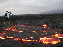
Lava breakouts are not just at the ocean, there are many molten ruptures taking place day and night all along and on top of the entire coastal plains; from the base of the Pulama Pali two miles to the shoreline.
, ,
Also, back to safety; variable winds lately can switch the sulphur dioxide, degassing from the entire coastal plains, right into your lungs. Not good to breath!!. This wind switching is even more of a danger where the lava enters the sea. There we have sulphuric acids and tiny glass particles and scalding steam; all forming constantly. These things can do more than just irritate the eyes, throat and lungs-- they can quickly cause severe damage. A good respirator should be close in hand when approaching the coastal ocean entry lava zone...
, .
Well gee.... since I am on a safety rant, maybe it's time to also remind hikers to the lava that the most dangerous area is an ocean entry that has become established and consistent. It is these areas that are quickly forming new land under water and along the flow front above the water. These are called deltas or lava benches. This is very unstable new land that is being undermined by the sea and is very weak rock; like making cement with too much sand in the mix...
, '
Lava benches will break off without notice; both small sections or hundreds of feet at at time. The result can be extremely explosive; tephra, molten lava rock flying through the air in all directions, a local szunami of hot scalding water, a rush of sulphuric acid and scalding steam, and solid inland cliffs fracturing into the ocean. I am serious about this, I have witnessed this happen many times; luckily from a safe distance. These bench collapses are often small sections but as the one I recorded in Nov. 2010 (two miles east of the current entry) you can see the violent action of a quarter mile of new delta suddenly breaking off in sections in the pre-dawn light. My original blog post on the event HERE Video here below (turn your audio up :):
,
,
, ,
Even from the County Lava Viewing area directly off the lava-severed end of Highway 130 both steam/laze by day and the same steam reflecting the red-orange lava colors by night can be seen; especially when the Trade Winds are light and variable as there are now.

Wednesday, December 5, 2012

Lava Lover Bo dies

Bo Lozoff; Photo courtesy Big Island Video News ~~~~~~~~~~ ~~~~~~~~~~ ~~~~~~~~~~ ~~~~~~~~~~ It has been difficult for me to write this posting; Bo Lozoff was my friend. I first met Bo when he stopped in at my roadside lava photo display booth three or four years ago. We hit it off right away and he became a regular visitor to the booth. We shared dinners at his home in Kalapana Gardens and, of course, at times walked the molten lava fields together. Bo was tragically killed in a motorcycle/car accident last Thursday afternoon, November 29th. ~~~~~~~~~~ ~~~~~~~~~~ ~~~~~~~~~~ ~~~~~~~~~~ Back when we first met, Bo was new to the Big Island and was fascinated by the lava, and wanted everyone to see it. He began doing casual lava tours for those interested in seeing it. His genuine excitement at seeing new molten lava breakouts was clearly evident on all his fun little lava reports that he placed on his LavaLoverBo YouTube website; "Oh my Lord! -- Just look at this beautiful breakout!" he would often exclaim as he recorded from his little flip-phone camera. We exchanged regular emails and phone calls regarding the lava activity, "I see rivers of lava pouring down the pali, we should get up there!", he might say.
Bo, in the green shirt & pointing, shows his tour group a new lava breakout. (Most of my photos of Bo are on another hard drive that I can't access at this time) ~~~~~~~~~~~ ~~~~~~~~~~~ ~~~~~~~~~~~ ~~~ ~~~~~~~~~~~~~~~~~~~~~~~~~~~~~~~~~~~~~~~~~~~~~~~~~~~~~~~~~~~~~~~~~~~~~~~~~~~~~~~~~~~~~~~~~~~~~~~~~~~~~~~~~~~~~~~~~~~~~~~~~~~~~~~~~~~ WAKE FOR BO --EDIT -Gathering for Bo changed today by Dale- It will NOT be on Friday night at Uncle Robert's-- No new time has been scheduled yet. Same with the Saturday spreading of ashes-- That has been rescheduled for December 16th - a Sunday: A celebration of Bo's life is not being held at Uncle Robert's This Friday, Dec 7th as planned. But there will be another tribute done with Bo's ashes the December 16th, a Sunday morning: Meet up at 7:00 AM in the lava viewing parking lot off the end of highway 130. Bo's neighbor and very close friend Dale will be leading a walk out to the ocean entry area of lava and spreading Bo's ashes in the lava flow. ~~~ ~~~ For pictures and video showing Bo, you can see them in a well done Big Island Video News report of the accident and a review of Bo's wildly creative life HERE. On there are links to Bo's websites, as well as resent interviews done with Bo about living close to the active lava.
Above, photo taken from Kalapana Gardens last night looking out at the entire coastal plains lava flow; the new ocean entry is the streaming glow on the left.

Monday, November 26, 2012

Ocean and Lava November 26, 2012

This mornings new ocean entry lava at sunrise; a tour boat takes in the beautiful scene~ ~~~~ ~~~~
Click on the images to open into a better view window.

Sunday, November 25, 2012

Flowing lava finds the sea again

After nearly one year, the lava flow from Kilauea's Pu`u O`o Crater has once again made it from eruption to the ocean, some seven miles downslope.
The last time lava from this same eruption was entering the ocean, at nearly the same location, was on December 30th, 2011. This surface flow on the coastal plains has been a long time marching the two miles from the Pulama Pali slopes to the sea; along the way it has made some impressively high mounds of inflated lavascapes. I will be out to document the ocean entry when I catch up on other pressing projects.

Tuesday, October 30, 2012

Lava activity has slowed but is stable; from craters to coast

Above: Setting full moon looks like a big star with the fisheye lens I used for this pre-dawn photo of the coastal plains flow front early this morning.
I always like to these pahoehoe roping & banding breakouts. ~~~
That lens does exaggerate the flow front activity though; breakouts were small and sparse across a widespread area below the Pulama Pali and out towards the ocean a mile or so. The eastern edge is close to three miles from Kalapana Gardens. This front remains about a mile from the sea and is not advancing much at all these days; especially since the recent drop in magma pressures in Kilauea Volcano’s chambers.
You can see the ups & downs and stabilizing of these magma pressures on the USGS/HVO Deformation (magma deflation- inflation) graph
USGS/HVO has been reporting the lava level inside the summit crater dropped to about 175 feet below the Halema`uma`u crater floor but rose back to about 100 feet during these deflation-inflation periods. ~~~~~~~~~~~~~~~~~~~~~~~~~~~~~~~~~~~~~~~~~~~~~ And finally:
We had a treat last night as the full moon rose over Kalapana Gardens: Rain showers moved through and when the bright rising moon shone on them we got to witness a double rainbow. Or ‘night-bow’ as locals sometimes say.
~~~ Click on any image to open a new view window and larger sizes ~~~

Sunday, October 28, 2012

BC Canada earthquake triggers shoreline evacuations for Hawaii (And an eruption update)

As most of you would have heard by now, at 8:04 PM PST a powerful 7.7 earthquake with the shallow depth of 17.5 kilometers/11-miles, took place offshore of northern British Columbia, Canada.
The quake initially generated local tsunami warnings between southern Alaska down the coast to California as well as for the Hawaiian Islands; (I have family living in a houseboat on the outer west coast of BC, so was very concerned as the first reports were issued.).
Interestingly, there was never a Pacific-wide tsunami warning, only for Hawaii. The rationale for this appeared later in the evening when the Pacific Tsunami Warning Center geologists posted this amazing computer generated wave projection graphic (screen capture of meteorologist Guy Hagi on Hawaii News Now below):
The graphic shows the computer model projected a narrow thrust of quake waves across the Pacific Ocean and directly to the center of the Hawaii Island chain; hence the statewide evacuation orders for all coastal communities here in Hawaii. Below is the news reporting the projected wave-surge heights for Hawaii:
I live in one of those evacuation zones and the warning sirens began at around 7:30 PM local HS Time and repeated every half hour until 11:00 PM. No I did not evacuate; I was feeling quite safe at this particular location. ~~~ I was tempted, though, to drive to Hilo and set my camera up in some safe location where I could still see the Hilo Bay front and record any wave surge we might have. Hilo was one of the areas forecast to get the highest impact from any tsunami action. Hilo Bay has a record of devastation when it comes to these things. This time around there were reports of receding water that left moored boats high and dry for a few minutes. By 4:00 AM this morning all watches and warning related to this quake event were cancelled. ~~~~~~~~~~~~~~~~~~~~~~~~~~~~ ~~~~~~~~~~~~~~~~~~~~~~~~~~~~~~~~~~~~~~~~~~~~~~~~~~~~~~~~~~~~~~~~~~~~~~~~~~~~~~~~~~~~~ ON THE LAVA FRONT
Above: The Halema`uma`u Crater at dusk showing high lava levels this week; Courtesy of USGS/HVO. ~~~~~~~ We had an exciting week here actually. Molten lava levels within the active vent on the floor of Kilauea Volcano Halema`uma`u crater rose even higher than my last blog posting of 125 feet (lava lake to crater floor brim). The highest level reported by USGS/HVO reached 89-feet a few days ago, then deflation of the magma reservoirs occurred sharply, lowering the lava a bit and halting the rise as shown in the graphic below:
During these past weeks of rising lava levels there has been increased local earthquake action; particularly in one area southeast of the summit crater, down the Chain of Craters road a little ways toward the coast:
~~~~~~~~~ And lastly, the photo below is one I took a couple nights ago from Kalapana Gardens. It looks like daytime because there was a nearly full moon and I overexposed the image to bring out both the lava glow activity on the Pulama Pali and coastal plains, which can be seen best in the larger image size. That cloud hung up there for most of the night as winds ceased in all directions for a while in between weather systems.
~~~~~~~~~~~~~~~~ Click on any image for a new window for a larger view size of all images ~~~~~~~~~~~~~~~ Meanwhile I am fascinated to watch the incredibly massive & powerful storm system approaching the US Atlantic coastline right now—The weather systems meeting up in that region look to have the makings of severe damage over a very wide area. The satellite imagery linked (tools & data) on the National Hurricane Center website really shows just how huge and widespread this hurricane has become. I am hoping all of you in that region are out of harms way.

Monday, October 22, 2012

Kilauea’s Halema`uma`u crater lava lake all time high level

It was back on March 19, 2008 when the Halema`uma`u crater floor had a small explosion creating an open hole down to the raw lava that connects to the massive magma chambers below Kilauea volcano; a crater within the crater. As I remember, the original vent hole was about 162 feet across and the molten lava was something like 800 feet below the floor of the crater. In the four and a half years since then, rises and falls of the broiling lake of lava inside the vent have steadily eroded the walls of the vent; widening it to 520 feet/160 m, in diameter. As well, lava levels have slowly risen and tending to maintain higher levels; currently around 165 feet below the main crater floor rim.
Above: USGS/HVO aerial image showing high molten lava lake level. Saturday, October 20, the USGS reported a brief rise of lava to 125 feet/38 meters below Halema`uma`u crater’s floor, as shown in a recent image they posted on this webpage. USGS Hawaiian Volcano Observatory expressed in a media release that if the lava lake reaches 65 feet below the crater floor rim, then it would be visible to the public from the parks observatory. Yesterday, in a local radio report, Dr. Jim Kauahikaua, HVO’s Scientist-in-Charge, voiced the possibility of this lava lake either breaching onto the main crater floor or creating an eruption in the Kilauea region between Halema`uma`u and Pu`u O`o craters; based on historical patters such as earthquake increases and magma conduit obstructions along with the high lava levels within the summit crater. That prospect is exciting! Big Island Video News posted a great report on these changing lava lake levels using USGS/HVO video: ~~~~~ Meanwhile: lava continues with small breakouts and inflation across a wide area of the coastal plains below the Pulama Pali; as well as tube breakouts above the pali.
Click on any image to open all these photos in a large view window.
After dark some of these molten breakouts can be seen from the lava viewing area next to Kalapana Gardens (2:00PM to 10:00PM.

Saturday, October 13, 2012

Large area of crusting lava on the coastal plains; diminishing advancement

Above: pre-dawn light on the coastal plains flow front, and below looking east with Venus & crescent moon rising. (Click on any of these pictures to open a larger size view window of all images)
~~~~~~~~~~~~ As of early this morning large sprawling areas of the recent coastal plains lava flows were stagnating but still inflating and random little breakouts all over, as well as a small breakouts far up the pali. These photos and captions tell the story~~
~~~~~~~~~~~~~ Above and below shots are that ropy pahoehoe~~
~~~~~~~~~~~~~ Below: Large cracks forming as strong inflation pushes from beneath from molten lava continuing to surge into the area from sources about six miles northwest; the Pu`u O`o crater and Kilauea east rift zone.
~~~~~~~~~~~~~~~~
Closer look at a fresh surge of pahoehoe. ~~~~~~~~ And finally,below, this was the view from Kalapana Gardens at 3:20 AM this morning (not much to see really); the lava coming down the Pulama Pali, four miles distant, has crusted over and formed tubes that now deliver the molten rock onto the coastal plains. (We cannot see the coastal lava from here). The lava is still over one mile away from the ocean, and at the current rate & stagnation levels, it may be some time before it reaches the sea, if at all. Lava was last entering the ocean December 31st, 2011.

Monday, October 1, 2012

Molten lava front pushing down the Pulama Pali

Above: the view from within Kalapana Gardens subdivision last night; the same view seen from the Hawaii County Lava viewing Area (located off the terminus of highway 130). The flow front is at around the 1000-foot/300-meter elevation and four miles distant.
Hundreds of yards/meters across, a wide and sprawling front of mostly pahoehoe type of lava with some small sections of the rough and jumbly A`a, are re-covering older lava as well as taking yet another slice out of the tattered remnants of the abandoned Royal Gardens subdivision kipuka forests.
Here are a few other photos I recorded a couple days ago at the flow front on the full moon; the last image is that full moon setting overtop the advancing lava.(Click on any image to open them all into a larger viewing window)
~~~~~~~~~~~~~~
~~~~~~~~~~~~
~~~~~~~~~~~

Tuesday, September 25, 2012

One-year anniversary of ‘Peace-Day’ eruption and flow field

Above is a September 25th, 2012 flow field map from the USGS image page. (Click for larger view of all images.)
September 21st, 2011 was the day Pu`u O’o crater was filled to the brim with molten lava and then spectacularly ruptured from its upper east flank, beginning a long-lived downhill progression of surface flows towards the sea.
By early December 2011 well-established and self-created tube delivery systems were spreading surface lava far and wide across the upper slopes of the Pulama Pali and (the mostly lava-covered) Royal Gardens subdivision. Days later lava was entering the ocean, which turned out to be a short lived event, ending the last day of 2011; and has not returned since.
Though the ocean entry ceased New Years Eve 2011, in the months afterwards, breakouts of lava continued fairly consistently along the entire ‘Peace-Day’ flow field; especially down the face of the pali and sprawling out on the coastal flats at the base of Royal Gardens.
The most poignant event of this flow to date being the destruction of Jack Thompson’s beautiful home and gardens on March 2nd, 2012.
The ensuing lava activity from last March onward were principally cycles of surface and lava tube breakouts on the Pulama Pali and coastal flats; again, never reaching the ocean. The most pronounced change was the cessation of breakouts at the beginning of this month but soon becoming active again high above the pali and, in recent days, once again flowing slowly down into the steeper sections of Royal Gardens; looking simular to this image I took of that skyline Dec. 31st, 2011:
I have been surprised at how my last posting (April 7th) was basically applicable to the flow field acivity for every month since then up to this recent short pause in activity. The Pu`u O`o is really filled up with lava again, not to the brim but full. Are we going to see another dramatic fissure flank eruption, or continued slow draining from the present Peace-Day flow field? Only Pele knows the answer I guess :)

As for my long absence from posting; I finished the lava movie except for minor edits. I am now working on the expensive and tedious mission to license the music for it. When that process is complete I will be publishing it far & wide. Meanwhile, I am also pursuing my other endeavors of Life… and …. Well I am still here and I will jump in with another lava update again soon …

Saturday, April 7, 2012

The lava continues flowing down south slopes of Hawaii Island - Your blogger takes a break

Above: A daytime aerial and a thermal imagery creates this composite photo of the current lava flow on the south slopes of the Pulama Pali courtesy of USGS/HVO images page.
Below, USGS/HVO daytime photo with notes I have added: (Click any image to open them all as larger size in a new window)


As these USGS Hawaiian Volcano Observatory (HVO) images clearly show, sprawling surface lava expands across the Coastal plains below Royal Gardens and remains about a mile from the ocean (To our backs in these images.) Lava also remains active in various places along the eruptive tube system between Pu`u O`o, the source, down the Pulama Pali and out onto the coastal plains.

I have not made the effort to hike out to the lava flow to investigate or document it. I have chosen to focus on my any other projects, including my lava movie. At this point in time I am considering taking a break from the Hawaiian Lava Daily for an unknown period of time.

Besides my other obligations and interests, I don't think I have much to offer you readers, my special lava followers, that is not now covered very well by our knowledgable and comprehensive (and paid) volcano experts - the United States Geological Survey's Hawaiian Volcano Observatory team.

The USGS/HVO has really improved their documenting of Kilauea's eruptions in recent years: numerous public cams with improved image quality, surface and aerial footage including those amazing thermal image composites with informative captions, detailed and updated mapping, an interactive earthquake page, an extensive data base of historic events, public awareness links, sites, updates and much more.

There were many times that if I did not hike out to locate and record the lava, or lack of, there would be few who would have any idea what was really taking place out there. Now I can sit on my computer here and with a couple of clicks, look in real time at much of the lava conditions day or night. And so can you.

Along the left side, or across the top, of many of the USGS/HVO web site pages there are clearly labelled navigation links that offer all these things I have mentioned - like these below: Kilauea Update | Mauna Loa Status | Seismic | Deformation (magma pressure tilt graph) | Current SO2 Conditions (Toxic fume direction/levels from both active craters) | Multiple Webcams | Flow Maps | Photos & Videos and many more great informational links.

So, my dear Lava Blog readers, I have truly enjoyed sharing my adventures with this ongoing world wonder, the Kilauea Volcano, with you. I have deeply appreciated the many emails, comments here and in-person encounters with so many of you; both locally and from the entire planet. I also must do a call-out to all of you who have jumped onboard my very special lava movie with your generous support. I am continuing to work on this feature film and will be meeting with my pro-editor in a few days to begin the fine-tuning. One hurdle remains to be music license costs, but we will solve that eventually.

I am not declaring that I am retiring Hawaiian Lava Daily. I am saying that for a few important reasons, including the reasons previously mentioned, I need to withdraw from it for awhile. That said… I have been known to change my mind with the weather… or be swayed by other irresistible elements ...

Aloha nui loa, A hui hou,
Leigh
P.S. If you have some time or the interest, Kim McMillon, a host on 'Arts In The Valley' (website linked here) out of California is also an AM radio station there that recently did an interview with me. We cover her questions about my lava videography & photography, Kilauea history and of my involvement with Jack Thompson and the story of his home lost to lava. The segment is about twenty minutes long: The Interview on mp3

I'll leave you with some random lava images below~~~